An expedition to the wreck site of HMCS Athabaskan, a Canadian WWII Destroyer
With war looming on the horizon the Canadian Navy ordered a series of warships know as the Tribal Class. Classed as destroyers these strongly armored warships played an active role in the allied war effort. Measuring 377’ in length and displacing 1,850 tons the Athabaskan was capable of a maximum speed of 36 Kts.
In the weeks just preceding the allied invasion of Nazi held France the Athabaskan was engaged in anti-submarine actions off the Northwest coast of France near the English Channel. After a successful engagement against two German Navy torpedo boats the Athabaskan was sunk during a night action against two German Navy Elbing Class destroyers. Struck by two torpedoes, the Athabaskan quickly sunk carrying with it its captain and 128 of its crew of 255.
The Athabaskan lay undisturbed in the cold waters off the French coast of Brittany until Mark Ward, the grandson of one of the Athabaskan’s offices who was lost in the sinking, organized a diving exhibition to locate the sunken vessel where it lays in almost 300’ of water. With the assistance of several local divers, and braving the strong tidal currents Mark succeeded in reaching the wreckage and laid a memorial plaque at the site.
In 2005 Mark approached the Aurora Trust about supporting a remote sensing expedition to the site to create a digital map of the wreckage and to search for the stern section of the vessel that had broken free when the vessel exploded just prior to sinking. Craig Mullen, a founding director of the Trust worked with Mark and organized an expedition to the site in September of 2004.
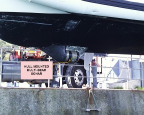
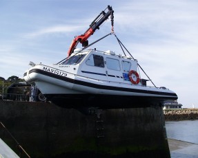
The Trust contracted with a French hydrographic survey company that mobilized a highly portable, 8.5M survey craft to the village of L’Alber Wrac’h, in Finistere, Brittany, France near where the remains of the Athabaskan was located. The survey craft as outfitted with Reson model 8101 multi-beam sonar as its principle survey instrument; a GPS navigation system and digital data recorders.
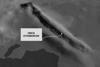
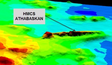
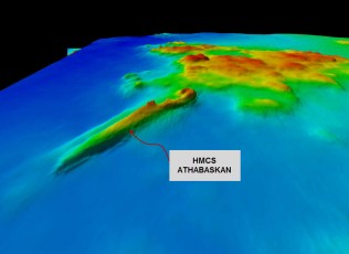
Initially the expedition enjoyed good success and relocated and mapped the principle wreck site with the multi-beam sonar. Sufficient data was collected to develop a picture of how the vessel lies on the bottom and the amount of the vessel remaining at the primary site.
Attempts to relocate the missing stern section and provide a higher resolution sonar image of the main wreckage were unsuccessful due to the strong (>8 Kts) tidal currents and deteriorating local weather conditions.